


Our Home · The Equality State
Wyoming
12,000+ Years of Land, People, Courage & American History
Before Wyoming was a state, before its cities, railroads and ranches, and long before its borders appeared on a map, people were already living and moving through these mountains, valleys, plains and river corridors.
This is the story of Wyoming—from its earliest human presence to the state we know today.
Explore the Journey A six-part SGN historical experience
12,000+Years of human history
1869Equality revolution
44thState in the Union
National Park Service / Public Domain
Scroll to exploreThe Opening Journey
Before Wyoming Had a Name
Wyoming's story did not begin with cowboys, railroads, territorial boundaries or statehood. It did not begin when explorers crossed the mountains or when wagon trains followed trails toward the West. Thousands of years before any place called Wyoming appeared on a map, human beings were already moving through this immense landscape, learning its seasons, following animals across the plains, finding water between mountain ranges and building lives in a land that could be breathtakingly beautiful and brutally demanding.
Evidence of human occupation in what is now Wyoming reaches back more than 12,000 years. The State of Wyoming identifies evidence associated with Clovis people approximately 12,000 years ago, Folsom traditions approximately 10,000 years ago and Eden Valley traditions approximately 8,000 years ago. Later communities continued adapting hunting-and-gathering economies to Wyoming's changing environment.
What archaeologists recover from that distant past is incomplete: stone tools, quarry sites, hearths, camps, animal remains and other traces that survived when countless other parts of everyday life disappeared. These fragments cannot tell us everything about the people who made and used them, but they establish something profound.
The human history of Wyoming is not measured merely in centuries. It is measured in millennia.
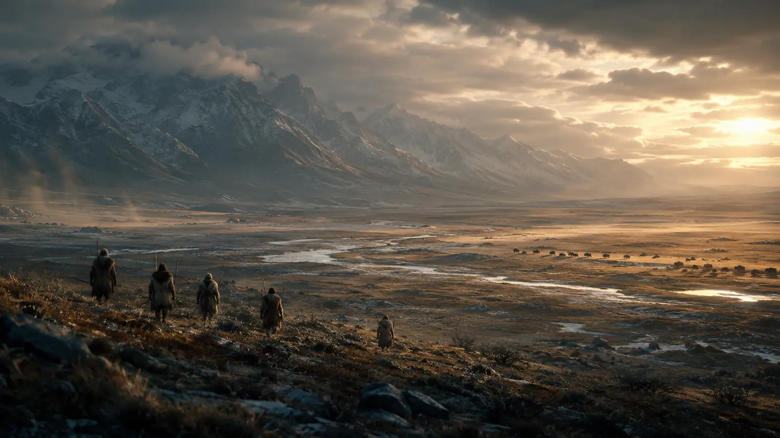
Ancient Wyoming
The Paleoindian World
The earliest chapters of Wyoming's known human history belong to a period archaeologists describe as Paleoindian. These communities lived during an era of enormous environmental change near the end of the Ice Age. Their world cannot be reconstructed perfectly, but archaeological evidence shows people adapting intelligently to vast landscapes, hunting, moving through large territories, using stone with extraordinary skill and developing knowledge that could be carried from one generation to another.
Names such as Clovis and Folsom are modern archaeological classifications rather than names by which those ancient people necessarily identified themselves. Archaeologists use such classifications because distinctive projectile points and other surviving evidence allow patterns to be recognized across places separated by great distances.
Wyoming's archaeological record therefore gives us fragments rather than a complete biography of its earliest inhabitants. Yet every surviving tool represents human decisions: where to travel, which material to select, how to shape it, when to move, where animals might be found and how to survive in an environment capable of extraordinary beauty and extraordinary severity.
The Land Shaped the People
Wyoming can appear from a distance to be one enormous open space. In reality, its geography is a complicated system of mountain ranges, high plains, basins, rivers, valleys and natural corridors. For people living here thousands of years ago, understanding that geography was not simply useful. It could be essential to survival.
Water, animals, shelter, useful stone and seasonal conditions influenced where people could travel and live. Mountain passes and river valleys created natural corridors across difficult terrain. Knowledge of a spring, protected valley, quarry or reliable route represented information that could matter across generations.
This is one of the reasons Wyoming's landscape cannot be treated merely as scenery surrounding its history.
The landscape helped create the history.
The Land Remains.
Generations changed. Cultures changed. Technologies changed. Wyoming's mountains, rivers, basins and plains continued shaping human life.
Stone, Knowledge & Survival
To modern eyes, a prehistoric stone tool may appear simple. Producing an effective cutting edge or projectile point, however, required knowledge, planning and practiced skill. People needed to know where appropriate stone could be found, how different materials fractured, how a tool should be shaped and how damaged equipment could be repaired or replaced.
Wyoming contains ancient quarry areas demonstrating that particular locations were known and repeatedly used. The Wyoming State Geological Survey notes evidence of Indigenous quarrying at Spanish Diggings, where high-quality toolstone was obtained and artifacts made from Wyoming material have been found across a much broader region.
Such evidence transforms our understanding of the landscape. These were not people wandering through an unknown wilderness. They possessed geographic knowledge, technological knowledge and relationships with particular places.
Indigenous Wyoming
Generations Across the Land
After the earliest Paleoindian periods, human life in Wyoming continued through thousands of years of cultural and environmental change. Communities adapted to different conditions, technologies developed, populations moved and relationships extended across territories far larger than today's political boundaries.
The State of Wyoming describes later prehistoric communities with mixed hunting-and-gathering economies and identifies subsequent populations as predecessors of peoples known during the historic period.
The Indigenous history of Wyoming cannot accurately be presented as a simple list of tribes placed inside the modern outline of the state. People moved, traded, formed alliances, experienced conflict and maintained relationships across the Northern Plains, Rocky Mountains and Great Basin long before today's state borders existed.
Nor does Indigenous Wyoming belong only to the past. Native communities remain part of Wyoming today. Indigenous history is therefore simultaneously an ancient story, a historical story and a living story.
Photo: U.S. Forest Service / Public Domain
Medicine Mountain
High in Wyoming's Bighorn Mountains lies one of the state's extraordinary cultural landscapes: Medicine Wheel/Medicine Mountain.
The stone wheel includes a central cairn connected by stone alignments to an outer circle. The State of Wyoming describes the Medicine Wheel as having 28 spokes and a circumference of approximately 245 feet.
Measurements alone, however, cannot explain the importance of the place. Medicine Mountain is a Native American sacred landscape, and its significance should not be reduced to an archaeological curiosity.
Standing high in the Bighorn Mountains, it reminds us that a landscape can carry meaning across generations even when governments, boundaries and written histories change.
The stones are physical.
The history surrounding them is much larger.
More Than a Mystery
Older historical presentations sometimes treated places such as Medicine Wheel primarily as archaeological mysteries. Mystery can attract attention, but it can also obscure something important: sacred landscapes can continue to hold meaning for living Indigenous peoples even when outsiders do not fully understand their history.
A respectful presentation therefore asks more than, “Who built this?”
It also asks what the place means to people connected with it today.
That question brings Wyoming's Indigenous history out of the museum case and into the present.
Before the Written Record Changed Everything
Thousands of years passed between Wyoming's earliest known human occupations and the explorers, traders and emigrants whose names dominate written histories of the American West. During that immense span of time, generations lived and died, communities changed, technologies developed and relationships with the landscape continued.
The absence of written American records from those early periods does not mean the absence of history. Archaeology, Indigenous knowledge, oral traditions and physical landscapes preserve different forms of evidence. Each has limitations, but together they remind us that recorded history represents only the most recent layer of a much older human story.
By the time outsiders began entering the region in increasing numbers, they were not entering a place without people, routes or history.
They were entering landscapes people had already known for thousands of years.
The Approach of Recorded Western History
A New Era Arrives
During the early nineteenth century, trappers and traders increasingly entered the region that would eventually become Wyoming. The fur trade connected distant markets with places that, to newcomers, seemed remote beyond imagination. Beaver pelts and later buffalo robes became commodities linking the Northern Plains and Rocky Mountains to much larger commercial networks.
But these newcomers were not entering an empty economic landscape. Indigenous peoples already maintained extensive systems of movement, exchange and geographic knowledge. Fort Laramie's National Park Service history notes that Plains Indian nations such as the Arapaho and Cheyenne participated in trading networks extending across North America before European and American traders established posts in the region.
Over time, trading relationships, migration and American expansion transformed those encounters. Places that initially connected traders and Native communities would later become staging points for enormous waves of westward migration and, eventually, military expansion.
One location would become especially important.
Fort Laramie
A Crossroads That Would Help Transform the American West
At the junction of the Laramie and North Platte Rivers, traders Robert Campbell and William Sublette established Fort William in 1834, the first trading post at the site that would eventually become known as Fort Laramie. The original post was small—approximately 100 by 80 feet—and built primarily to support trade, including the buffalo-robe trade with Native peoples of the region.
The post changed hands and changed form. Fort William was replaced by the adobe Fort John in 1841. As growing numbers of emigrants traveled west, the site became increasingly important as a place for information, supplies, repairs and rest. In 1849, the United States Army purchased the post, beginning its transformation into a major military installation on the Northern Plains.
For decades, Fort Laramie stood at the intersection of enormously different human experiences: Native nations, fur traders, emigrants, soldiers, families and others encountered one another within a rapidly changing West. The National Park Service today describes the site as a place that witnessed both America's westward expansion and Indigenous resistance to encroachment on Native territories.
Soon, the number of people crossing Wyoming would increase dramatically.
The trails were coming.
Next in the Wyoming Story
The Land Was Ancient.
The Next Few Decades Would Change It Forever.
For thousands of years, Wyoming's human story unfolded without railroads, American cities or state boundaries. Then the pace of change accelerated. Explorers came. Trappers and traders established new commercial networks. Trails widened. Emigrants began crossing the region in growing numbers. Fortifications appeared. And the ancient landscapes of Wyoming were becoming one of the great crossroads of the American West.
Continue the Journey ↓Trails Across a Continent
The American West Was Moving Through Wyoming
During the middle decades of the nineteenth century, the landscapes of present-day Wyoming became part of one of the greatest movements of people in American history. Emigrants bound for Oregon, California and Utah followed routes that converged across Wyoming, traveling along rivers, past landmarks and eventually toward the Continental Divide.
These were not modern highways with one clearly defined strip of pavement. Wagon traffic spread across corridors, divided into alternate routes and rejoined farther west. Over time, repeated passage left physical marks in the landscape—some of which remain visible today.
Four routes now recognized as National Historic Trails—the Oregon, California, Mormon Pioneer and Pony Express trails—share an important corridor through central Wyoming and the South Pass region.
Wyoming was becoming a crossroads of a continent.
≈500,000
People Crossed South Pass During the Great Overland Migration Era
Between approximately 1840 and 1869, an estimated half-million overland emigrants crossed South Pass on their way toward Oregon, California, Utah and other western destinations.
South Pass
The Gateway Through the Rockies
A traveler hearing the words “crossing the Rocky Mountains” might imagine an almost vertical wall of stone. South Pass is striking for a different reason. It is broad, open and gradual—an unusually practical passage across the Continental Divide that made large-scale wagon migration possible.
The National Park Service describes South Pass as perhaps the most important landmark along the emigrant trails. Its gradual ascent allowed wagons to cross the Continental Divide without confronting the kind of steep mountain barrier travelers might have expected. Some emigrants recorded that the ascent was so gentle they could scarcely tell when they had reached the divide.
That geography changed American history. The routes of the Oregon, California and Mormon Pioneer trails passed through this region, and the Pony Express later followed the same historic corridor.
Today, the landscape can appear quiet.
In the nineteenth century, it was one of the great gateways of North America.
Photo: Carol M. Highsmith Archive, Library of Congress — No known restrictions on publication.
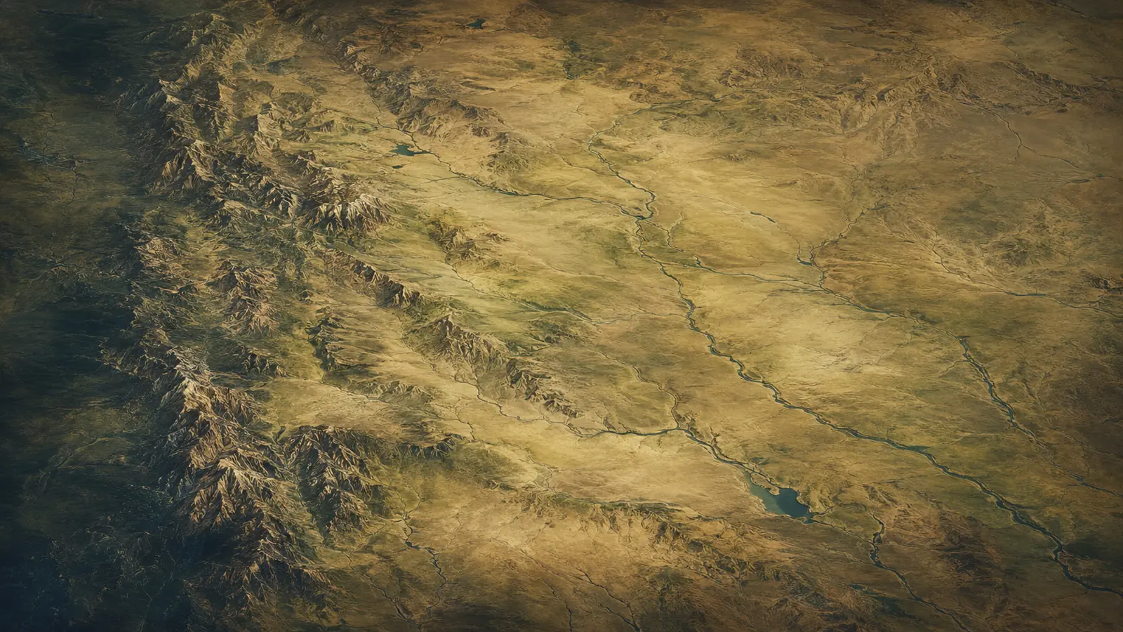
Four Great Routes — One Wyoming Corridor
Oregon Trail. California Trail. Mormon Pioneer Trail. Pony Express Trail.
Across central Wyoming, these nationally recognized historic trails shared important portions of the same corridor before travelers continued toward different destinations in the West.
THE TRAIL WAS BIGGER THAN A WAGON TRACK
It is easy to imagine the Oregon Trail as one narrow road stretching neatly across the West. The reality was far more complicated. Travelers followed broad corridors containing parallel wagon tracks, alternate routes, shortcuts and places where trails divided or rejoined. Weather, water, grazing conditions, geography and changing destinations could all affect which route an emigrant company chose.
The great trails followed portions of the North Platte and Sweetwater river systems toward South Pass. Beyond the divide, routes separated toward Oregon, California, Utah and other destinations. Over time, some wagon corridors became extraordinarily broad as repeated traffic searched for better ground.
The trail was therefore not merely a line on a map.
It was a moving human landscape.
Families traveled with possessions, livestock and hopes for a different future. Traders and freight operators moved supplies. Military forces traveled portions of the same routes. Mail systems followed them. Telegraph infrastructure later connected parts of the same corridor.
The pathways across Wyoming were becoming arteries of continental change.
INDEPENDENCE ROCK
A LANDMARK IN AN OCEAN OF DISTANCE
Across the enormous distances of the overland journey, landmarks became milestones. One of the most famous was Independence Rock, a massive granite formation rising from the landscape near the Sweetwater River.
For emigrants, such landmarks provided more than scenery. They offered reassurance that progress was being made and became reference points in diaries and travel accounts. The Mormon Pioneer company of 1847 reached Independence Rock on June 21 before continuing toward South Pass six days later.
Many travelers carved names and dates into prominent landmarks along the trails, leaving physical traces of individual journeys within a much larger migration.
To a modern traveler, Wyoming can be crossed in hours.
For people moving west by wagon or on foot, every landmark represented another stage in an extraordinary journey.
FOLLOWING THE SWEETWATER
West of Independence Rock, emigrants followed the Sweetwater River toward the Continental Divide. The landscape brought them past landmarks including Devil's Gate, Split Rock and eventually South Pass. Today, many of these places remain nationally recognized parts of Wyoming's historic trail corridor.
Water was essential. So was grass for animals. The landscape could determine whether a journey progressed smoothly or became dangerous. Heavy trail traffic placed pressure on natural resources, while weather could change conditions dramatically. Travelers constantly balanced distance, water, forage, health and time.
The great migration is often represented by the romantic silhouette of a covered wagon.
The reality was much harder.
People walked enormous distances. Animals became exhausted. Wagons broke. Illness spread. Weather changed. Rivers had to be crossed. Families buried loved ones along the route and continued west because turning around could be as difficult as moving forward.
The trail represented possibility.
It also demanded endurance.
A JOURNEY TOWARD A NEW HOME
In 1847, Mormon pioneers traveled west toward the Great Salt Lake Valley. Their route joined the broader emigration corridor in Wyoming, passing Fort Laramie, Independence Rock and South Pass before continuing toward Fort Bridger and eventually into what is now Utah.
The National Park Service records that the 1847 pioneer company crossed the North Platte near Fort Laramie, reached Independence Rock on June 21 and crossed South Pass on June 27. The route would become a major pathway for Mormon emigration over the following decades.
Their journey added another dimension to Wyoming's role in westward migration. People crossing the region were not all traveling for the same reason. Some sought farmland. Some pursued gold. Some sought religious community. Others were traders, soldiers, entrepreneurs, mail carriers or people simply looking for a different future.
The trails converged geographically.
The motivations of the people traveling them were remarkably diverse.
GOLD, OPPORTUNITY & THE WESTERN RUSH
The discovery of gold in California transformed westward migration. The routes across Wyoming carried people driven by dreams of wealth as well as those seeking farms, communities or religious refuge farther west.
Between 1849 and 1852 alone, the Bureau of Land Management reports that roughly 150,000 pioneers went west through the broader trail system. By the middle of the 1850s, stagecoaches and freight wagons had become regular users of the California, Mormon Pioneer and Oregon trail corridors through South Pass.
The movement was changing Wyoming even when most emigrants had no intention of remaining there.
They needed supplies.
They needed crossings.
They needed information.
They needed forts and trading posts.
They needed routes through mountains and across rivers.
The infrastructure of migration began creating the infrastructure of a future territory.
THE LANDER ROAD
By the late 1850s, the federal government was becoming increasingly involved in improving routes across the West. The Lander Road, completed in 1858, became the first federally sponsored wagon road for emigrants heading toward Oregon and California.
The route provided a more direct passage through portions of southwestern Wyoming and southeastern Idaho. According to the National Park Service, it shortened the older route by approximately 60 miles and offered improved access to food and water for travelers and livestock.
This was another important transition.
The earliest emigrants had followed routes discovered and developed through Indigenous knowledge, fur-trade travel, exploration and experience. Now the federal government was deliberately investing in transportation infrastructure across the West.
The trail era was becoming more organized.
And something much faster was coming.
THE PONY EXPRESS
BEFORE THE TELEGRAPH, INFORMATION RODE HORSEBACK
For a brief period in 1860 and 1861, Pony Express riders carried mail across the continent at extraordinary speed for their time. Wyoming's South Pass corridor formed part of the approximately 2,000-mile route connecting St. Joseph, Missouri, with California.
The Pony Express lasted only about nineteen months, but it became one of the enduring symbols of the American West. Its short life also demonstrates how quickly technology was changing. What required relays of horses and riders in 1860 would soon be overtaken by the transcontinental telegraph.
Wyoming was witnessing different eras overlap.
Wagon trains still crossed the landscape.
Horseback couriers raced along established routes.
Telegraph lines were advancing.
And engineers were preparing for something that would transform distance more dramatically than any wagon road ever could.
The railroad was coming.
FOR GENERATIONS, PEOPLE FOLLOWED THE LAND.
NOW STEEL WOULD CROSS IT.
The railroad would compress distances, create towns, redirect commerce and help determine where modern Wyoming would grow.
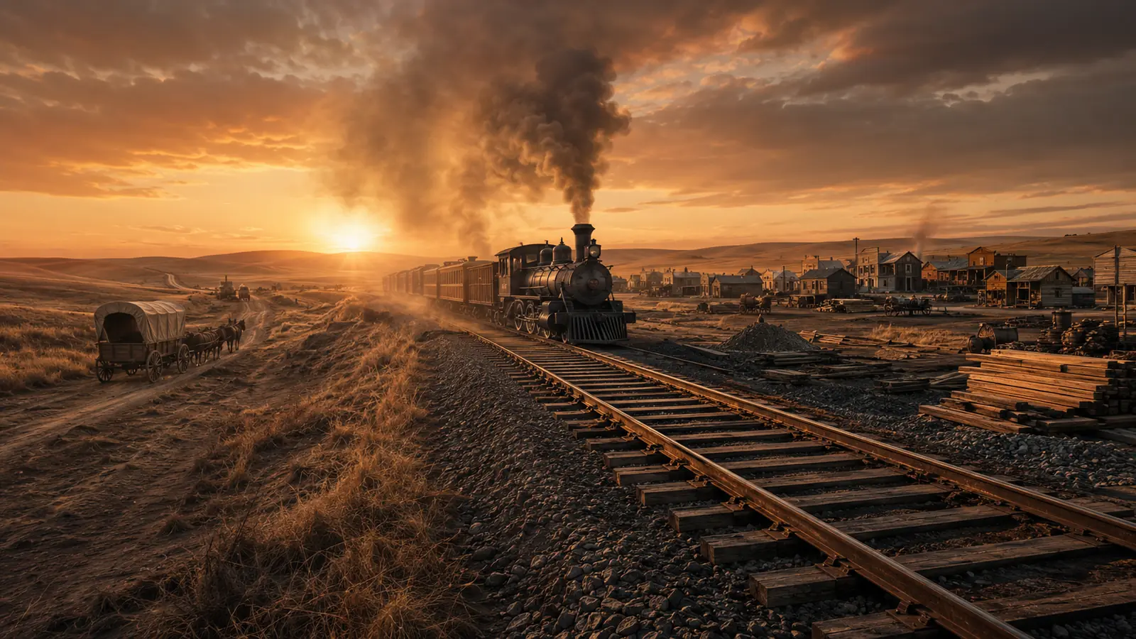
1867 · A New CorridorSteel Crosses the High Plains
THE RAILROAD CHANGES EVERYTHING
In 1867, the Union Pacific Railroad entered present-day Wyoming.
That simple date marks one of the greatest turning points in the state's modern history.
For emigrants, Wyoming had often been a landscape to cross. The railroad required something different. It needed permanent infrastructure, stations, workers, maintenance, supplies and communities. Places that could support railroad operations gained new importance, while transportation patterns that had dominated the trail era began to change.
The railroad did not erase the old routes immediately. Wagons, stages and freight traffic continued. But the logic of movement was changing. A journey that once depended on animals, weather, river crossings and months of endurance could increasingly be measured according to rail schedules.
New towns emerged along the tracks.
And one of those towns would become the political heart of Wyoming.
CHEYENNE
A CITY BUILT AROUND A NEW AGE OF MOVEMENT
The railroad created conditions for settlements to emerge with extraordinary speed, and Cheyenne became one of the defining examples.
Its location along the Union Pacific corridor positioned the new community within a transportation network connecting the nation. Workers, merchants, entrepreneurs and others arrived as railroad construction advanced westward. What had recently been open country was becoming a town tied directly to one of the largest infrastructure projects in American history.
Cheyenne's importance soon extended far beyond the railroad. When Wyoming Territory was organized, Cheyenne became the center of territorial government. It would later remain the capital when Wyoming entered the Union as a state.
The story of Wyoming was moving rapidly now.
Within only a few years, railroads, towns and political institutions were reshaping the region.
TWO ERAS MEET
For a period, the trail era and railroad era existed side by side.
Wagons still moved across established routes while railroad crews pushed tracks west. Stagecoaches connected places the rails had not yet reached. Telegraph systems accelerated communication. Freight moved by different methods depending on destination and available infrastructure.
Then the balance shifted.
The completion of the transcontinental railroad in 1869 dramatically reduced the importance of the great overland wagon migration. Wyoming's own historical account notes that overland traffic on the Oregon Trail had already entered sharp decline by 1867 as completion of the railroad approached.
The old wagon ruts did not disappear.
They became history.
SOUTH PASS BECOMES A TOWN
South Pass had already shaped migration across the continent when another force changed its history: gold.
The discovery of gold in the region in 1867 led to the establishment and rapid growth of South Pass City. For a short period, mining transformed an area famous as a passage through the mountains into one of Wyoming's most important settlements. The State of Wyoming notes that South Pass City became Wyoming's largest settlement before the boom eventually turned to bust.
Mining towns could rise quickly because expectations rose quickly. Prospectors arrived. Businesses followed. Buildings appeared. Money circulated. Then, when deposits failed to meet expectations or economic conditions changed, populations could disappear almost as quickly.
South Pass City would nevertheless leave an influence far greater than its population.
Its next chapter would help change the political rights of women.
WYOMING TERRITORY
JULY 25, 1868
As railroads, settlements, mining and federal activity transformed the region, political boundaries changed as well.
On July 25, 1868, Congress created the Territory of Wyoming, assembling land that had previously been parts of the Dakota, Idaho and Utah territories.
The new territory now had a political identity of its own.
Its government would formally begin operating the following year. John A. Campbell, appointed territorial governor by President Ulysses S. Grant, became Wyoming's first territorial governor.
The name Wyoming was now attached not merely to a landscape on maps, but to an organized American territory.
And almost immediately, that young territory would make a decision that would give Wyoming an international historical identity.
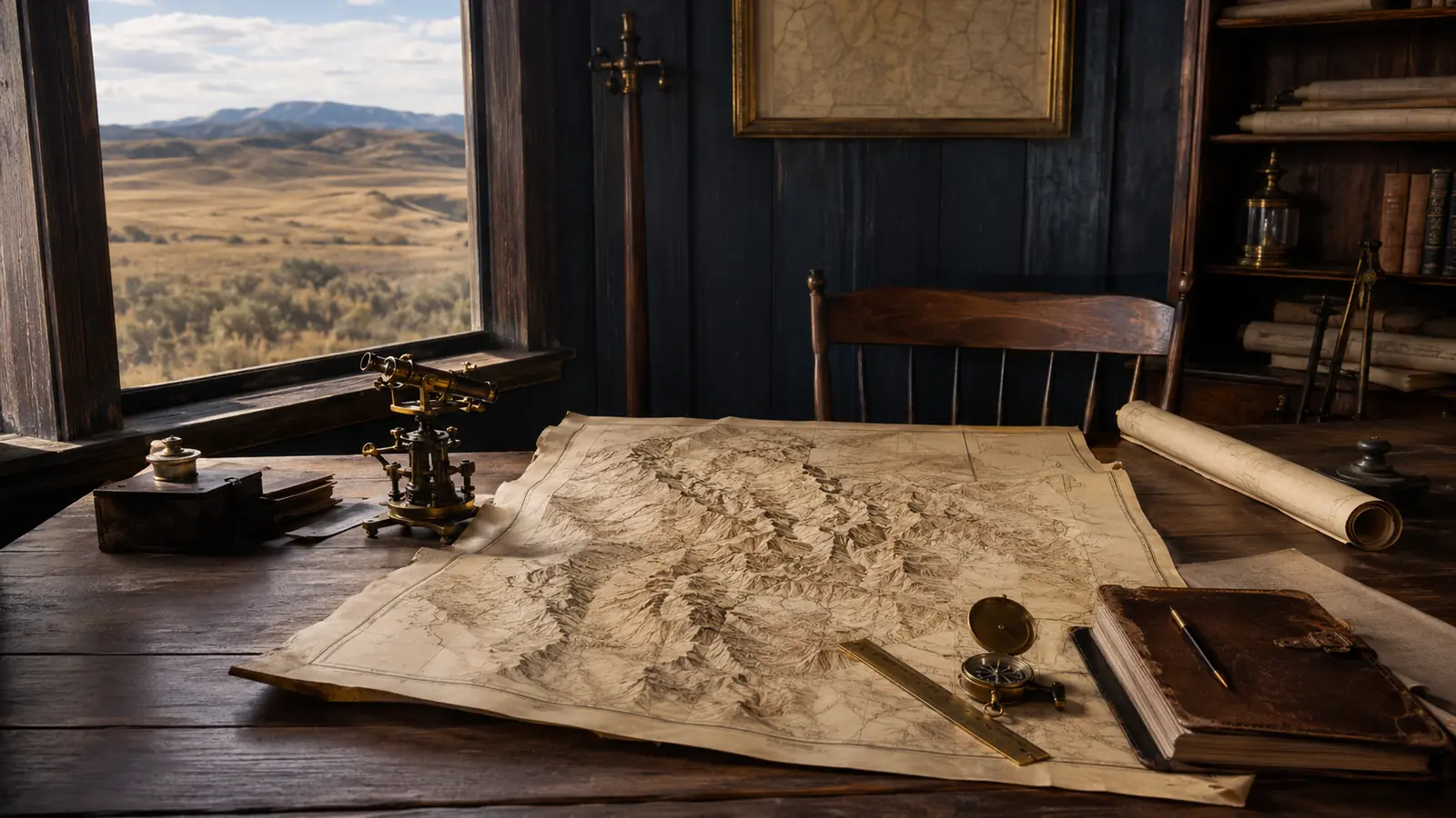
July 25, 1868A Territory Takes Shape
A Nation in Motion
FROM TRAILS TO TERRITORY
In a single generation, established trails became transportation networks, towns and territorial government.
And before 1869 was over, Wyoming would make history.
DECEMBER 10, 1869
WYOMING CHANGES THE MEANING OF EQUALITY
Wyoming Territory was barely established when its first territorial legislature made a decision that would permanently shape the state's identity.
On December 10, 1869, Territorial Governor John A. Campbell signed legislation granting women the right to vote.
Wyoming became the first government within the jurisdiction of the United States to grant women voting rights on this basis.
This was decades before ratification of the Nineteenth Amendment prohibited denying the right to vote on account of sex nationwide.
A young western territory with a small population had taken an extraordinary step.
Wyoming's future nickname was beginning to take shape:
THE EQUALITY STATE
December 10, 1869Equality Enters the Law
EQUALITY MOVES FROM LAW TO LIFE
The significance of Wyoming's 1869 law became visible almost immediately.
On February 17, 1870, Esther Hobart Morris of South Pass City was appointed justice of the peace, becoming the first woman known to hold that judicial office in the United States. Women also began serving on juries in Wyoming Territory.
Then, on September 6, 1870, Louisa Swain cast a ballot in Laramie, becoming widely recognized as the first woman to vote in a general election under equal suffrage laws in the United States.
The story was no longer merely about a bill passed by legislators.
Women were voting.
Women were serving in public life.
And Wyoming's experiment with equality was becoming part of American history.
FROM MINING TOWN TO A PLACE IN HISTORY
South Pass City had been born from gold, but its most enduring contribution to Wyoming's story would not come from a mine.
It became closely associated with Esther Hobart Morris, whose appointment as justice of the peace in 1870 placed a woman in a judicial position at a time when women across most of the United States could not even vote.
The transformation is remarkable.
Only a few years earlier, South Pass was principally known as a geographic gateway through the Rocky Mountains.
Then it became a mining boomtown.
Then it became connected to one of the defining chapters in the history of women's political rights.
Wyoming's landscapes were accumulating layers of history at extraordinary speed.
WYOMING WAS BECOMING SOMETHING NEW
By the end of the 1860s, the transformation was extraordinary.
A region crossed for thousands of years by Indigenous peoples had become a major corridor of American migration.
Fort Laramie had evolved from a trading post into a military installation.
Hundreds of thousands of emigrants had passed through South Pass.
The Pony Express had raced across the territory and disappeared almost as quickly as it arrived.
The telegraph had changed communication.
The railroad had entered Wyoming.
Cheyenne had emerged beside the tracks.
Gold had created South Pass City.
Congress had created Wyoming Territory.
And in 1869, that new territory had extended voting rights to women.
Yet Wyoming's most internationally famous contribution to conservation history was still ahead.
Only a few years later, a landscape in the northwestern corner of the territory would become the center of an unprecedented American experiment.
THEN AMERICA LOOKED TOWARD WYOMING'S WILDERNESS.
YELLOWSTONE — THE WORLD'S FIRST NATIONAL PARK
Steam rose from the earth.
Geysers erupted.
Canyons cut through volcanic landscapes.
Wildlife moved across enormous ecosystems.
And in 1872, a revolutionary idea would permanently change the relationship between government, land and conservation.
Continue the Journey ↓
03
Part 3 of 6
Yellowstone, Conservation & Statehood
The land America protected and the state Wyoming became
Part 3 of 6
YELLOWSTONE
THE LAND AMERICA DECIDED TO PROTECT
Before there were paved roads, visitor centers or generations of family photographs beside Old Faithful, expeditions entered northwestern Wyoming and encountered a landscape that challenged ordinary description. Geysers erupted from the earth. Hot springs displayed extraordinary colors. Steam rose from geothermal basins. Waterfalls plunged through immense canyons, while mountains, forests, rivers and wildlife extended across a landscape that seemed unlike almost anything Americans had previously imagined.
The Yellowstone region was not unknown or uninhabited before these expeditions. Native peoples had long-standing connections to the greater Yellowstone landscape. Yet during the nineteenth century, scientific exploration and increasingly powerful visual documentation brought Yellowstone before a national audience in a new way.
The 1871 Hayden Geological Survey included photographer William Henry Jackson and artist Thomas Moran. Jackson's photographs and Moran's artwork gave people far away something they had never previously possessed: visual evidence of Yellowstone's extraordinary character. Their work became part of the national conversation surrounding protection of the region.
Within a year, the United States would do something unprecedented.
BEFORE YELLOWSTONE WAS A NATIONAL PARK
The creation of Yellowstone is sometimes told as though a magnificent wilderness was simply discovered and immediately protected. The real history is more complex.
The region had a much older Indigenous history. During the nineteenth century, explorers and organized expeditions added written descriptions, maps, scientific observations, sketches and photographs to an expanding American record of Yellowstone. The Folsom-Cook-Peterson expedition explored the region in 1869, followed by the Washburn-Langford-Doane expedition in 1870. In 1871, the Hayden expedition conducted the government-sponsored scientific survey whose documentation helped bring the region before Congress and the nation.
Photography was still relatively young, making Jackson's work particularly powerful. People who might have dismissed descriptions of Yellowstone as exaggeration could now look at photographs of its rivers, canyon walls, waterfalls, thermal formations and landscape.
The photographs did not create Yellowstone's value.
They helped people far away see it.
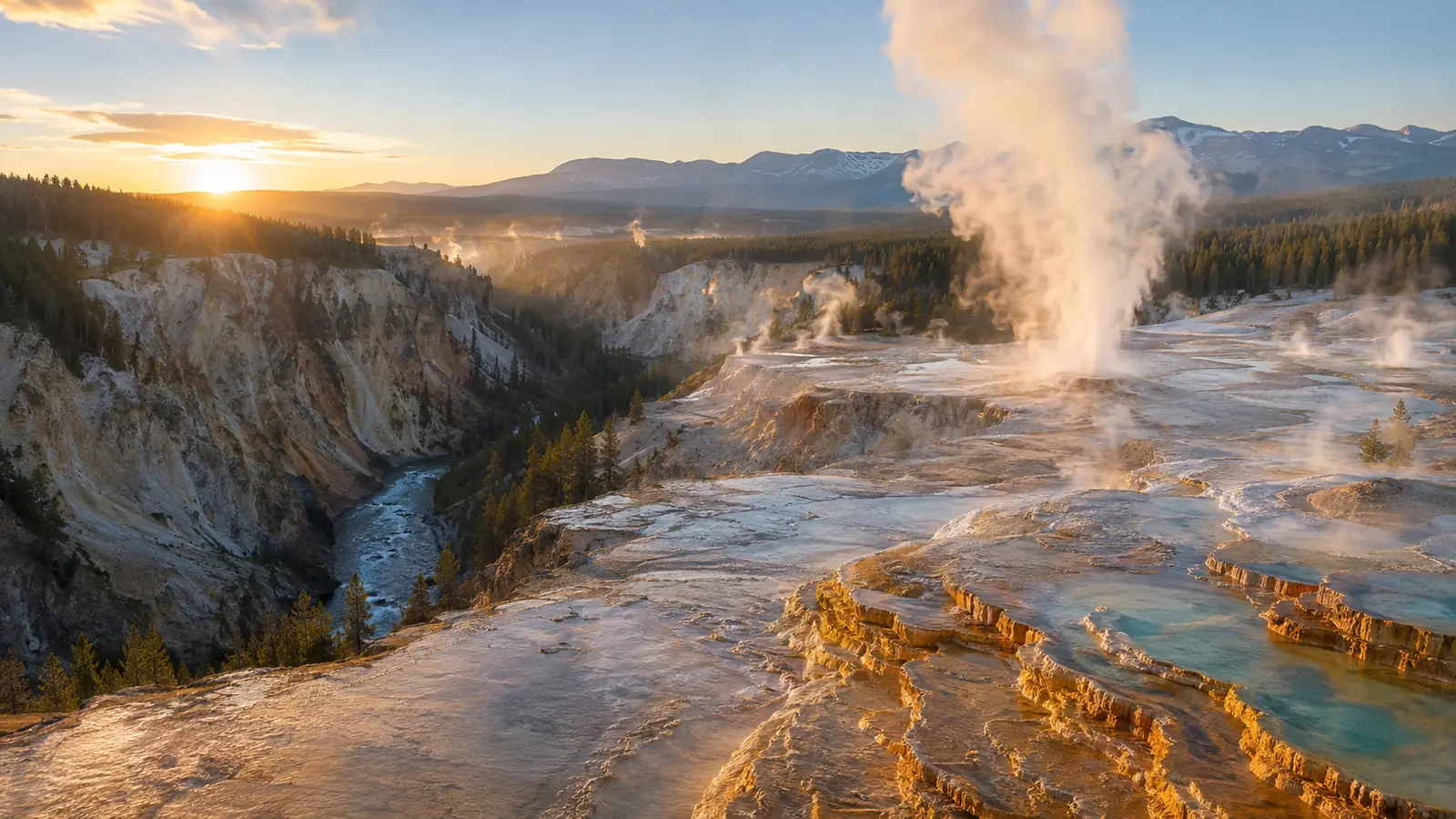
March 1, 1872The National Park Idea
MARCH 1, 1872
AN IDEA THAT CHANGED THE WORLD
On March 1, 1872, President Ulysses S. Grant signed the Yellowstone National Park Protection Act.
Yellowstone became the first national park.
The law withdrew the designated land from settlement, occupancy and sale and reserved it as a public park for the benefit and enjoyment of the people. What began in Yellowstone established a concept that would eventually spread across the United States and around the world.
The decision was remarkable because nineteenth-century American expansion had frequently been defined by acquiring land, settling it, extracting resources from it, building across it and converting it into private or commercial use.
At Yellowstone, the federal government chose another path.
Some land would be protected because what existed there was considered extraordinary enough to preserve.
The national park idea was born.
And much of Yellowstone lay within the territory that would become Wyoming.
№ 1
THE WORLD'S FIRST NATIONAL PARK
Yellowstone was established on March 1, 1872, beginning a national park movement that later spread far beyond Wyoming and the United States.
A LAW WAS ONLY THE BEGINNING
Creating Yellowstone on paper did not automatically protect Yellowstone on the ground.
When the park was established in 1872, there was no National Park Service. That federal agency would not be created until 1916. Early Yellowstone administrators had limited resources and little enforcement capacity. For years, the idea of a protected national park existed ahead of the government systems needed to manage one effectively.
The National Park Service notes that Yellowstone initially lacked funding for meaningful administration. In 1878, superintendent Philetus Norris finally received a modest federal appropriation and used part of the money to employ a year-round gamekeeper.
This is an important part of the Yellowstone story because preservation is not accomplished simply by declaring that something deserves protection.
Protection requires institutions.
It requires people.
It requires enforcement.
It requires public support.
It requires generations willing to defend an idea after the people who first proposed it are gone.
MORE THAN GEYSERS
Yellowstone became famous for geothermal wonders, particularly geysers such as Old Faithful, but the protected landscape was much larger than its most recognizable attractions.
The park encompasses mountains, rivers, forests, canyons, lakes, geothermal systems and habitat supporting an extraordinary range of wildlife. Today Yellowstone forms the core of the Greater Yellowstone Ecosystem, one of the world's largest nearly intact temperate-zone ecosystems.
That ecological understanding developed over time. Early protection often emphasized scenery and geological wonders. Modern conservation recognizes something broader: individual landscapes, wildlife populations, watersheds, habitats and natural processes are connected.
Yellowstone therefore represents more than an American destination.
It became one of the places where society gradually learned to think differently about land itself.
A TERRITORY TAKES SHAPE
While Yellowstone was introducing a new conservation idea to the world, Wyoming Territory continued developing through the closing decades of the nineteenth century.
The railroad remained central to economic and population growth. Ranching expanded across portions of the territory. Mining continued to shape communities and transportation. Towns grew around commercial, agricultural, railroad and governmental activity. Territorial institutions became more established, and communities that had emerged rapidly during the previous decade began developing more permanent identities.
Cheyenne strengthened its role as the political center of the territory. Laramie developed as an important railroad and educational community. Other settlements expanded across a vast region whose population remained small compared with many eastern states but whose geographic scale was enormous.
In 1887, the University of Wyoming opened in Laramie. The following year, in 1888, Wyoming's Capitol building was completed in Cheyenne. By 1889, the territory was preparing a constitution and making the case that Wyoming was ready to join the Union as a state.
Only twenty-one years had passed since Congress created Wyoming Territory.
The frontier territory was preparing to become a state.
1887
A UNIVERSITY BEFORE STATEHOOD
The University of Wyoming opened in Laramie in 1887, three years before Wyoming entered the Union.
The sequence is significant. Wyoming was still a territory when it established the institution that would become its public university.
The young territory was not simply building towns and railroads.
It was building institutions intended to outlive the frontier era.
A CAPITOL FOR A FUTURE STATE
The Wyoming Capitol in Cheyenne was completed in 1888, while Wyoming was still a territory.
Its construction made a powerful statement about permanence. The railroad town established only two decades earlier was now home to a monumental government building designed for a political future beyond territorial status.
Within its walls, Wyoming's path to statehood would take one of its most important steps.
In 1889, delegates gathered for a constitutional convention.
They were writing the fundamental document of a state that did not yet legally exist.
1889
WYOMING WRITES ITS CONSTITUTION
In 1889, delegates met in Cheyenne for the Wyoming Constitutional Convention.
Writing a state constitution required decisions about government, public institutions, rights and the political identity Wyoming intended to carry into the Union. One issue already distinguished Wyoming sharply from most of the country: women had been voting in Wyoming Territory since 1869.
Statehood raised a fundamental question.
Would Wyoming abandon that principle in order to make admission to the Union easier?
It did not.
The new constitution preserved women's political rights. National Archives material notes that Wyoming's Constitution explicitly recognized voting rights for both men and women and that Wyoming entered the Union without surrendering that principle.
What had begun as territorial legislation twenty years earlier was becoming part of the constitutional identity of a state.
EQUALITY WOULD ENTER THE UNION WITH WYOMING.
Wyoming did not treat women's suffrage as a temporary territorial experiment to be discarded for political convenience.
The principle survived the constitutional convention.
It survived the statehood debate.
And it entered the Union with Wyoming.
National Archives accounts of the period emphasize that opposition existed in Congress precisely because Wyoming permitted women to vote. Wyoming nevertheless became a state with those rights intact.
That decision permanently connected Wyoming's statehood with the history of American political equality.
THE ROAD TO THE UNION
With a constitution prepared, Wyoming sought admission to the United States.
Statehood legislation was introduced in Congress in December 1889. The measure passed the House in the spring of 1890, and the statehood process continued through Congress despite political debate surrounding the territory's population and its unusually broad voting rights for women.
Wyoming's population was small.
Its political ambitions were not.
The territory had established a government, built a Capitol, opened a university, developed rail and commercial networks and created a constitution.
Now the question moved to Washington:
Would Wyoming become a state?
JULY 10, 1890
WYOMING BECOMES A STATE
On July 10, 1890, Wyoming Territory was admitted to the Union.
THE 44TH STATE
President Benjamin Harrison signed the statehood measure, completing Wyoming's transition from territory to state.
The change had taken only twenty-two years from the creation of Wyoming Territory in 1868.
Those twenty-two years had contained extraordinary transformation: railroad expansion, growing towns, mining booms and busts, the establishment of territorial institutions, the opening of a university, construction of the Capitol, women's suffrage, the creation of Yellowstone National Park and the drafting of a state constitution.
Now the word Wyoming identified one of the United States of America.
THE EQUALITY STATE
Many states acquire famous identities long after admission to the Union.
Wyoming entered statehood with one already developing.
Women's suffrage had been law in the territory since 1869. Women had served on juries. Esther Hobart Morris had served as a justice of the peace. Louisa Swain had cast a ballot in Laramie. When Wyoming wrote its Constitution and sought admission as a state, women's political rights remained part of the state's structure.
This history gave Wyoming a national identity extending far beyond its population.
The phrase Equality State was not simply a marketing slogan.
It grew from a political history in which Wyoming repeatedly entered national conversations about women's rights before much of the country had taken the same steps.
Three decades would pass after Wyoming statehood before ratification of the Nineteenth Amendment in 1920 prohibited denial of voting rights on account of sex nationwide.
Wyoming had already been living with women's suffrage for half a century.
A STATE OF FIRSTS
1869
Women's voting rights in Wyoming Territory
1870
Esther Hobart Morris becomes a pioneering woman justice of the peace
1872
Yellowstone becomes the first national park
1890
Wyoming enters the Union with women's political rights preserved
The pattern would continue.
Wyoming was becoming known not merely for its landscapes, but for being willing to do things before much of the nation did.
TWO IDEAS BIGGER THAN WYOMING
Yellowstone and women's suffrage may initially seem to belong to completely different histories.
One concerns land.
The other concerns political rights.
Yet both demonstrate something remarkable about territorial-era Wyoming: ideas emerging from this sparsely populated western region would become part of much larger American and international stories.
Yellowstone helped establish the national park concept.
Wyoming's equality history challenged conventional limits on women's political participation.
The state was physically enormous and lightly populated.
Its historical influence could be much larger than its population suggested.
FROM YELLOWSTONE TO STATEHOOD
1871
The Hayden Survey documents Yellowstone through science, mapping, photography and art.
March 1, 1872
Yellowstone becomes the world's first national park.
1870s–1880s
Wyoming communities, railroad networks, ranching, mining and territorial institutions continue developing.
1887
The University of Wyoming opens in Laramie.
1888
The Wyoming Capitol is completed in Cheyenne.
1889
Wyoming holds its Constitutional Convention.
December 1889
Statehood legislation is introduced in Congress.
July 10, 1890
Wyoming becomes the 44th state.
STATEHOOD WAS NOT THE END OF THE WYOMING STORY.
It was the beginning of another one.
The new state would enter the twentieth century shaped by railroads, ranching, mining, energy, agriculture, wildlife, national forests and enormous federal lands. Its communities would continue growing, changing and confronting the tensions that accompanied economic development across the American West.
Wyoming would experience conflict over land and power.
It would watch the rise and decline of industries.
It would produce more national firsts.
It would elect the first woman governor in American history.
It would become home to the nation's first national monument.
Its extraordinary landscapes would increasingly become national symbols.
And through all of those changes, the identity of the Equality State would continue evolving.
WYOMING WAS NOW A STATE.
CONTINUE THE JOURNEY ↓
NOW IT HAD TO BUILD ITS FUTURE.
The railroad had connected it.
Equality had distinguished it.
Yellowstone had helped introduce it to the world.
Statehood had given it a permanent place in the Union.
The twentieth century would test what Wyoming would become.
THE MAKING OF MODERN WYOMING
NEXT IN THE WYOMING STORY
Ranches and cattle country. Mining and energy. National forests and wildlife. Devils Tower. The Cowboy State. Conflict and change. Nellie Tayloe Ross—and another American first.
CONTINUE ↓
04
Part 4 of 6
The Making of Modern Wyoming
1890 to 1945
Part 4 of 6
THE MAKING OF MODERN WYOMING
Land, Cattle, Minerals, Conservation & Change
Statehood did not suddenly transform Wyoming into the state we recognize today. In 1890, enormous distances still separated communities. Railroads connected important settlements, but much of the young state's economy and identity remained tied to land, livestock, mining, agriculture and the realities of living in one of America's largest and least densely populated places.
During the decades that followed, ranching expanded, agricultural communities adapted to a dry climate, mining towns developed around valuable resources, and oil became increasingly important. New roads, automobiles, aviation and communications gradually changed the meaning of distance. At the same time, the federal government became increasingly involved in forests, wildlife, water, public lands and natural-resource management.
The Wyoming that entered the twentieth century was therefore a place of remarkable contrasts: private ranches beside enormous public lands, growing towns surrounded by vast open country, industrial development beside nationally protected landscapes, and a small population whose state repeatedly appeared at the center of much larger American stories.
The Equality State was becoming known by another enduring name: the Cowboy State.
CATTLE COUNTRY
Cattle ranching became one of the defining industries and images of Wyoming, but the real history was considerably more complicated than the romantic cowboy mythology that later surrounded the American West. Ranching depended on weather, water, grazing land, transportation, markets and enormous amounts of physical labor. The expansion of railroads connected Wyoming cattle producers with distant markets, while large ranching operations and open-range practices allowed livestock to graze across extensive areas.
Cowboys were essential workers within that economy. They moved cattle, maintained herds, repaired equipment and worked across landscapes where conditions could change rapidly from summer heat to violent storms and severe winter cold. Over time, the cowboy became more than an occupation; the image became part of Wyoming's cultural identity and helped give the state its famous nickname, the Cowboy State.
Yet the range was changing. Fences became increasingly common, property boundaries became more consequential, homesteads expanded, and competition over land and livestock intensified. Questions about who controlled grazing land, cattle and political influence contributed to serious tensions.
Those tensions exploded dramatically in 1892 during what became known as the Johnson County War. Armed men associated with powerful cattle interests entered Johnson County intending to confront people they accused of cattle theft. The expedition triggered an armed conflict that became nationally famous. The episode involved economic power, competing ranching interests, accusations of rustling, political influence, violence and intervention by authorities. It should not be reduced to a simple story of heroes and villains.
The Johnson County conflict represented something larger about the changing West. The era of an apparently unlimited open frontier was disappearing. Private property, public lands, water rights, grazing access and government authority were becoming increasingly formalized. The modern West would still be defined by enormous landscapes, but those landscapes were now governed by increasingly complex systems of ownership, law and public policy.
PROTECTING THE LAND
Wyoming's extraordinary role in American conservation did not end with the creation of Yellowstone. In 1891, land surrounding Yellowstone was set aside as the Yellowstone Park Timberland Reserve. Through later federal actions, protected forest lands in the region evolved into what is today Shoshone National Forest, which the U.S. Forest Service recognizes as America's first national forest.
Today Shoshone encompasses approximately 2.4 million acres in northwestern Wyoming, including vast wilderness, mountains, forests, rivers and wildlife habitat. Its history reflected a growing national realization that America's natural resources could not simply be treated as unlimited. Forest protection affected watersheds, wildlife, timber, grazing and the long-term future of western communities.
Wyoming's public lands would become one of the defining characteristics of the state. National parks, national forests, monuments and other federal and state lands exist alongside ranches, farms, towns, tribal lands and energy development. For different people, those lands can represent conservation, grazing, hunting, recreation, tourism, cultural history, energy or livelihoods—and often several of those things simultaneously.
Then, in the opening years of the twentieth century, Wyoming became the location of another conservation first.
DEVILS TOWER — AMERICA'S FIRST NATIONAL MONUMENT
In northeastern Wyoming, an extraordinary geological formation rises dramatically above the surrounding landscape. Yet the history and meaning of the place are much older than its federal designation. The National Park Service recognizes the Tower as sacred to more than twenty Native American tribes, and Indigenous names associated with the place include Bear Lodge. This cultural significance must be presented as part of the history, not as a decorative footnote.
On September 24, 1906, President Theodore Roosevelt proclaimed Devils Tower National Monument under the newly enacted Antiquities Act. It became America's first national monument. Wyoming therefore occupied an extraordinary position in the development of American conservation: Yellowstone had become the world's first national park in 1872, and Devils Tower became America's first national monument in 1906.
These federal designations represent only particular chapters in landscapes with much older histories. The importance of Devils Tower did not begin when a president signed a proclamation, just as Yellowstone's human history did not begin with the creation of a national park. Wyoming's landscapes contain overlapping geological, Indigenous, conservation and modern histories, and the page should allow those histories to coexist.
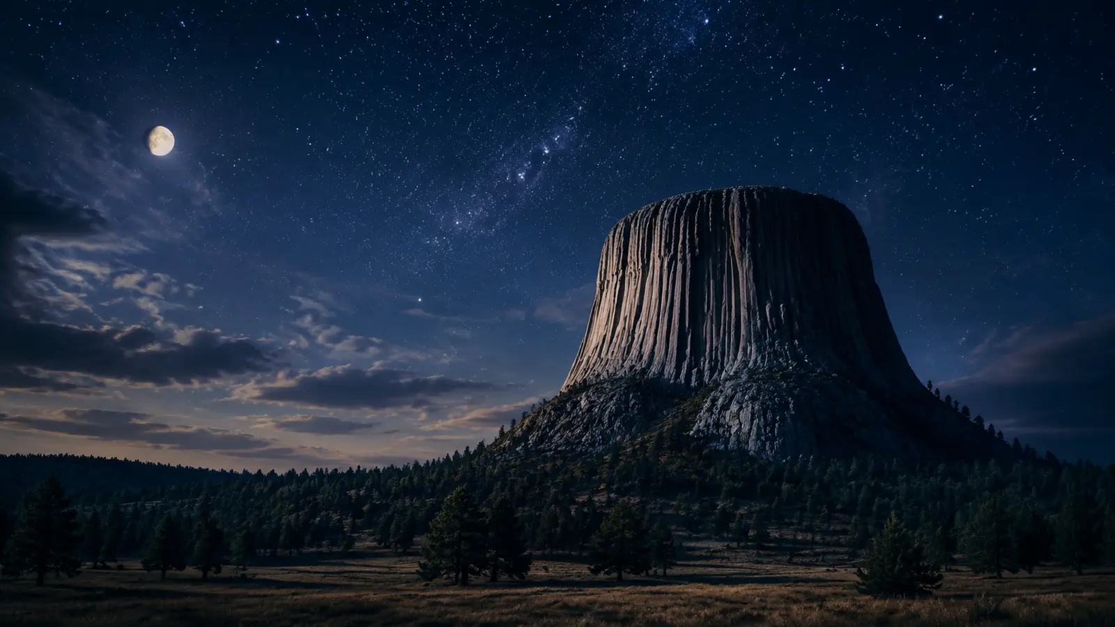
September 24, 1906A Monument Rises
THE ENERGY BENEATH WYOMING
Wyoming's landscapes contain more than extraordinary scenery. Beneath them lie enormous geological resources that became increasingly important to the state's economy and to the nation. Coal had played a role in Wyoming's development since the railroad era, when steam locomotives required enormous quantities of fuel and mining communities developed near deposits capable of supplying the expanding transportation system.
The geological story of Wyoming coal stretches back tens of millions of years, to ancient environments profoundly different from the Wyoming we see today. Over geological time, organic material accumulated, was buried and transformed, creating coal deposits that would eventually become major economic resources. Mining created communities and employment, but it also tied local economies to national industrial demand and to the cycles of resource development.
Oil added another powerful industry. Exploration and production brought investment, workers and infrastructure to different parts of Wyoming. As automobiles, mechanized industry and military needs transformed the American economy, petroleum became increasingly important. The Salt Creek region became particularly significant in Wyoming's petroleum history.
Natural resources also connected Wyoming to national political controversy. During the 1920s, the federal petroleum reserve associated with Teapot Dome became the center of one of the most famous corruption scandals in American history. Secret leasing arrangements involving federal oil reserves during President Warren G. Harding's administration led to investigations and national outrage. “Teapot Dome” became shorthand for government corruption for generations.
For Wyoming, the episode demonstrated something that would remain important throughout the twentieth and twenty-first centuries: what lies beneath Wyoming soil can have consequences far beyond Wyoming.
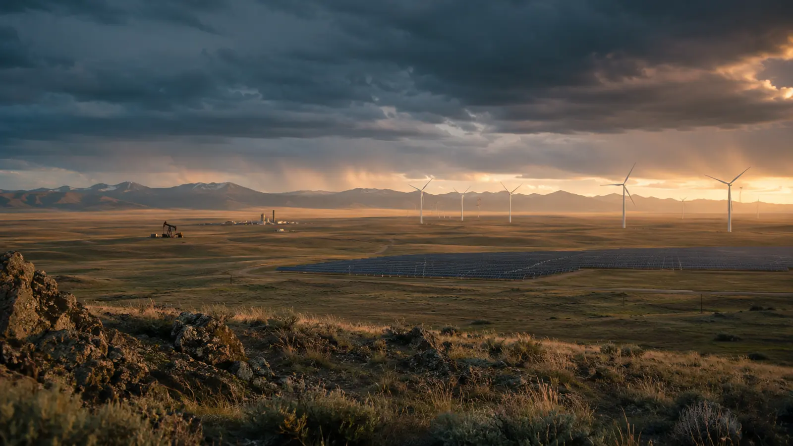
Work · Power · ChangeEnergy Country
MAKING A LIVING IN A DRY LAND
Agriculture in Wyoming has always required adaptation to the environment. High elevation, relatively short growing seasons in many areas, low precipitation and enormous distances create conditions unlike those of America's wetter agricultural regions. Livestock production became particularly suited to large portions of the state, while irrigation allowed crops to be grown where natural rainfall alone would not have been sufficient.
Water consequently became one of Wyoming's most important resources. Rivers, reservoirs, irrigation systems and water rights influenced where agriculture could develop, where communities could grow and how ranches and farms could survive. Decisions involving water frequently extended far beyond a single property because western rivers cross political boundaries and serve many competing needs.
This relationship between land and water remains fundamental to understanding Wyoming. Ranching, farming, wildlife, cities, industry, recreation and conservation may all depend upon the same watersheds. In a dry western state, water is not simply part of the landscape. It helps determine the possibilities of the landscape.
FROM RAIL TO ROAD TO SKY
The railroad had transformed Wyoming during the nineteenth century, but the twentieth century brought new transportation revolutions. Automobiles gradually gave individuals greater freedom of movement, changed commerce and transformed tourism. Road development connected communities in new ways, while destinations such as Yellowstone and Devils Tower increasingly became part of the great American road journey.
Aviation compressed distance still further. By 1920, transcontinental air-mail planes were crossing Wyoming. Only a few generations earlier, emigrants had required months to cross the American West. The railroad reduced that journey dramatically; automobiles changed personal mobility; aircraft began making the enormous landscapes below part of a national network measured increasingly in hours rather than weeks or months.
Wyoming's geography had not changed.
The human experience of distance had.
NELLIE TAYLOE ROSS
America's First Woman Governor
Wyoming's association with women's political participation had begun before statehood. Women gained voting rights in Wyoming Territory in 1869, Esther Hobart Morris entered judicial history in 1870, and Louisa Swain cast her historic ballot in Laramie that same year. More than half a century later, the Equality State produced another American first.
Nellie Tayloe Ross entered Wyoming politics following the death of her husband, Governor William B. Ross, in October 1924. She subsequently became a candidate for governor and won the election. On January 5, 1925, Ross took office as Governor of Wyoming, becoming the first woman governor in the history of the United States. Wyoming's official history records that she took office before Miriam “Ma” Ferguson of Texas, who had been elected on the same day.
Her historical importance continued beyond Wyoming. In 1933, President Franklin D. Roosevelt appointed Ross Director of the United States Mint. She became the first woman to lead the Mint and served for approximately two decades. A woman who had made political history in Cheyenne went on to occupy another nationally significant leadership position in Washington.
The symbolism for Wyoming was powerful. The territory that had extended voting rights to women in 1869 had entered the Union with those rights preserved and, in 1925, became the state where the first woman governor in American history took office.
WYOMING, CAUGHT ON CAMERA
The Great Depression reached Wyoming as it reached communities throughout the United States. Agriculture, livestock, mining, businesses and families faced the consequences of national economic collapse. Federal New Deal programs expanded public works, conservation projects and employment initiatives, changing the relationship between Washington and communities across the country.
The Depression era also left an extraordinary visual historical record. Federal photographers documented workers, towns, mines, farms, roads and ordinary American life. Their photographs allow us to look directly into Wyoming during the late 1930s and early 1940s—not through an artistic reconstruction, but through actual moments captured by photographers working during the period.
Images of places such as Cambria, Laramie and the University of Wyoming reveal a state between eras. Ranching, mining and railroads remained important, while automobiles, aviation, modern education, electricity, communications and federal institutions were increasingly shaping everyday life.
Cambria, Wyoming, 1937 — a historic coal-mining community.
Main Street, Laramie, Wyoming, 1940.
The University of Wyoming, Laramie, 1940.
HEART MOUNTAIN
A Difficult American History on Wyoming Soil
World War II transformed the United States, and Wyoming became part of the national mobilization through military activity, transportation, agriculture, energy, mineral resources and the service of men and women from Wyoming communities. Yet the war also brought one of the most difficult chapters of twentieth-century American civil-liberties history directly onto Wyoming soil.
During World War II, the federal government forcibly removed people of Japanese ancestry from the West Coast under wartime policies that deprived thousands of American citizens and residents of their liberty. One of the confinement centers was established between Cody and Powell, Wyoming. The Heart Mountain Relocation Center opened in 1942.
Families transported to Heart Mountain attempted to create community under conditions imposed upon them by the federal government. Schools, newspapers, activities and other elements of ordinary life developed inside a place whose residents had not freely chosen to live there. Barbed wire, guard towers and restrictions on movement existed beside efforts by families to preserve education, community and dignity.
Heart Mountain belongs to Wyoming history because it happened on Wyoming soil, and it belongs to American history because the policies that created it were national. Its inclusion here is essential. A serious history cannot preserve only the chapters that inspire pride while ignoring those that require reflection.
Wyoming's story contains equality, conservation, innovation and national firsts. Heart Mountain reminds us that democratic principles also require protection during periods of fear, crisis and war. Remembering difficult history does not diminish the Wyoming story. It makes that story more complete.
THE OLD WYOMING & THE NEW
By the end of World War II, Wyoming had changed dramatically from the territory admitted to the Union in 1890. Railroads, ranching, agriculture and mining still mattered enormously, but automobiles, highways, aviation, electricity, telecommunications, federal programs, modern industry and military infrastructure were creating a different state.
New resources would also influence Wyoming's future. Trona, discovered in Sweetwater County in 1938, would eventually become an important part of the state's mineral economy. Military infrastructure around Cheyenne would grow in importance as the United States entered the postwar and Cold War eras. Energy development would expand on a scale nineteenth-century Wyoming could scarcely have imagined.
The frontier era had become history.
Modern Wyoming had arrived.
From Frontier State to Modern Wyoming
FROM FRONTIER STATE TO MODERN WYOMING
Eight turning points trace Wyoming's transformation from a young state to the threshold of its modern age.
1891The forest reserve that would evolve into Shoshone National Forest is established.1892The Johnson County conflict erupts.1906Devils Tower becomes America's first national monument.1920Transcontinental air-mail service crosses Wyoming.1925Nellie Tayloe Ross takes office as America's first woman governor.1930sThe Great Depression reshapes Wyoming communities and its economy.1942Heart Mountain Relocation Center opens.1945World War II ends, and Wyoming enters a new American era.
THE FRONTIER HAD BECOME HISTORY.
NEXT IN THE WYOMING STORY
WYOMING'S MODERN AGE WAS BEGINNING.
In little more than half a century of statehood, Wyoming had become many things at once: a ranching state, an agricultural state, a mining and energy state, a conservation state, a state of enormous public lands, a place connected to difficult wartime history and, still, the Equality State.
Its landscapes remained immense, but Wyoming was no longer isolated from the forces transforming America. Its resources contributed to the national economy, its protected landscapes attracted visitors from around the world, transportation and aviation reduced the barriers of distance, and its political history continued producing national firsts.
The generations after World War II would inherit all of this—land, resources, institutions, conflicts, achievements and responsibilities—and would build the Wyoming we recognize today.
WYOMING IN THE MODERN AMERICAN AGE
The postwar transformation. The Blizzard of 1949. F.E. Warren Air Force Base and national defense. Interstate highways and aviation. The modern energy economy. Yellowstone and Grand Teton. Wildlife and conservation. Native communities. Tourism. Education. Modern Cheyenne. And the Wyoming of the twenty-first century.
CONTINUE THE JOURNEY ↓
05
Part 5 of 6
WYOMING ENTERS THE MODERN AMERICAN AGE
A New Era Across an Ancient Landscape
When World War II ended in 1945, Wyoming entered an era of transformation. The foundations of the state remained familiar—ranching, agriculture, mining, railroads, public lands and small communities separated by enormous distances—but the technologies and institutions surrounding them were changing rapidly.
Automobiles and highways increasingly determined how people traveled. Commercial aviation connected Wyoming with distant cities. Electricity, telecommunications and modern machinery changed homes, farms, ranches and businesses. Federal defense installations became increasingly important as the United States entered the Cold War, while energy development expanded Wyoming's role in the national economy.
Yet modernization did not erase the characteristics that had defined Wyoming for generations. The state remained sparsely populated. Weather and distance still mattered. Ranching remained culturally and economically important. Wildlife continued moving through some of America's largest intact landscapes, and public lands remained central to questions about conservation, recreation, energy and local livelihoods.
Modern Wyoming would develop through the continuing interaction between those two forces:
change and continuity.
THE BLIZZARD OF 1949
When Winter Tested Wyoming
In January 1949, a devastating winter storm struck Wyoming and other parts of the northern Great Plains and Rocky Mountain region. Snow, severe cold and powerful winds created enormous drifts, blocked roads and rail lines, isolated communities and stranded people and livestock. Additional storms followed, extending the emergency and making the winter one of the most remembered weather disasters in Wyoming history.
The scale of the crisis demonstrated how vulnerable even a modernizing state remained to the power of its environment. Roads disappeared beneath drifting snow. Transportation was disrupted. Ranchers struggled to reach livestock. Communities that normally depended on roads and railroads suddenly faced isolation.
Military personnel, government agencies, local communities and private citizens participated in relief efforts. Aircraft were used to help deliver supplies and feed to areas that could not easily be reached from the ground. The response became a story not only of extreme weather, but of cooperation across a state where distance could make an emergency even more dangerous.
Wyoming's history had always been shaped by the environment. The Blizzard of 1949 showed that modern technology had changed the state's relationship with nature—but had not conquered it.
F.E. WARREN AIR FORCE BASE
Wyoming & America's National Defense
Cheyenne's connection to the United States military reaches back to the nineteenth century. Fort D.A. Russell was established in 1867 near the developing railroad community. The installation evolved through different eras of American military history and was later renamed in honor of Francis E. Warren, Wyoming's first state governor and longtime United States senator.
Following creation of the United States Air Force, the installation became Francis E. Warren Air Force Base in 1949. Its mission would eventually become closely associated with America's strategic missile forces. Today, F.E. Warren remains an important military installation and a major part of the Cheyenne community.
The relationship illustrates another dimension of Wyoming's geography. The state's central continental location, enormous open spaces and relatively low population density have made portions of Wyoming strategically important to national defense.
Cheyenne therefore developed simultaneously as Wyoming's capital, a transportation center, a regional community and a military city.
That combination remains part of its modern identity.
HIGHWAYS CHANGE THE MAP
The interstate highway era changed Wyoming's relationship with the rest of the country. Interstate 80 created a major east-west transportation corridor across southern Wyoming, broadly following the continental transportation logic that had previously attracted emigrant trails, telegraph infrastructure and the transcontinental railroad. Interstate 25 linked Cheyenne northward through central Wyoming and south toward Colorado, while Interstate 90 became a major corridor across northeastern Wyoming.
The technology changed, but geography continued influencing transportation. Travelers who once crossed Wyoming by wagon had been followed by rail passengers, motorists and commercial trucks. Modern highways allowed people and goods to cross the state at speeds nineteenth-century emigrants could never have imagined.
The highways also changed tourism. Yellowstone, Grand Teton, Devils Tower, historic trail sites and Wyoming communities became more accessible to millions of Americans traveling by automobile.
For Wyoming businesses and communities, highways became economic arteries.
For visitors, they became windows onto the landscape.
GRAND TETON
Conservation Was Never Simple
The jagged Teton Range rises with extraordinary abruptness above Jackson Hole, creating one of the most recognizable landscapes in the American West. Grand Teton National Park was originally established in 1929, but the protected landscape familiar today emerged through decades of political debate, private land acquisition and federal action.
John D. Rockefeller Jr. played an important role by purchasing substantial acreage through the Snake River Land Company with the intention of eventually protecting it. In 1943, President Franklin D. Roosevelt proclaimed Jackson Hole National Monument, a controversial action that intensified local and national arguments over federal authority, private property, conservation and the future of the valley.
In 1950, legislation combined most of Jackson Hole National Monument with the earlier Grand Teton National Park, creating much of the park structure recognized today. The history demonstrates that conservation decisions—even those now widely celebrated—can involve difficult arguments over land, government, local interests and national priorities.
Wyoming's conservation story was never simply a story of beautiful landscapes being effortlessly protected.
Protection was often debated.
Sometimes fiercely.
And those debates remain part of the history.
YELLOWSTONE AFTER A CENTURY
Yellowstone entered its second century as one of the most recognized protected landscapes on Earth. Yet managing a national park had become far more complicated than simply protecting geysers and scenic views. Scientists and park managers increasingly understood Yellowstone as an ecological system involving wildlife, vegetation, fire, geothermal activity, rivers, migration corridors and relationships extending beyond park boundaries.
The 1988 Yellowstone fires became one of the most dramatic events in modern park history. Large fires burned across substantial portions of the park during an exceptionally dry year, creating enormous public attention and debate. The landscape that followed also became an important demonstration of ecological recovery and the natural role fire can play in many western ecosystems.
Wildlife management evolved as well. One of the most internationally recognized conservation actions came in 1995, when gray wolves were reintroduced to Yellowstone after having been absent from the park for decades. Their return became the subject of extensive scientific study as well as continuing debate involving conservation, livestock, wildlife management and communities outside park boundaries.
Yellowstone had begun as an extraordinary nineteenth-century experiment in protecting land.
By the twenty-first century, it had also become an enormous living laboratory for understanding ecosystems.
ENERGY COUNTRY
Few subjects explain modern Wyoming more clearly than energy.
The state's geology contains enormous deposits of coal, oil, natural gas, uranium and trona. During the second half of the twentieth century, technological change and growing national energy demand transformed resource development across portions of Wyoming.
The Powder River Basin became internationally important for coal production. Large surface mines transformed the scale at which coal could be extracted and transported, while long trains carried Wyoming coal to power plants across the United States. Oil and natural gas development continued in different regions, connecting rural Wyoming landscapes with national and global energy markets.
Southwestern Wyoming also became a major center of trona production. Trona is processed into soda ash, an industrial material used in products ranging from glass to chemicals and detergents. Wyoming's deposits are among the world's most significant natural trona resources.
Uranium has also played a role in the state's resource history, particularly during periods of strong national demand associated with nuclear energy and defense.
In more recent decades, Wyoming's powerful winds have attracted increasing interest in wind-energy development. The state's energy conversation now includes traditional fossil fuels, renewable energy, transmission infrastructure, carbon-management technologies and questions about what role Wyoming will play in America's future energy system.
Energy has brought employment, revenue and economic opportunity.
It has also created difficult questions involving market cycles, environmental impacts, land use, climate policy and communities whose economies can depend heavily on resource industries.
Wyoming's energy story is therefore not simply about what the state produces.
It is about how a resource-rich state navigates change.
Work · Power · ChangeEnergy Country
THE COWBOY STATE IS STILL WORKING
Modern Wyoming may be associated with energy, tourism and national parks, but agriculture and ranching remain fundamental to the state's culture, landscape and economy.
Cattle and sheep operations continue across large areas, while irrigated farms produce crops suited to Wyoming's climate and geography. Ranch families may work land connected to generations of history while simultaneously using satellite technology, modern machinery, advanced veterinary practices, digital markets and sophisticated water-management systems.
The modern ranch therefore connects two Wyomings.
One is the Wyoming represented in historical photographs: horses, cattle, fences, weather and enormous distances.
The other is technologically advanced and connected instantly to national and global markets.
The cowboy did not disappear.
The work evolved.
WILD WYOMING
Wyoming remains home to some of North America's most remarkable wildlife populations and migration systems. Elk, mule deer, pronghorn, bison, moose, bighorn sheep, bears, wolves, eagles, sage-grouse and many other species occupy landscapes extending from high mountains and forests to sagebrush basins and open plains.
Wildlife does not recognize the boundaries visible on political maps. Animals may move between national parks, national forests, federal lands, state lands, tribal lands and private ranches during different seasons. Protecting migration corridors and habitat can therefore require cooperation among governments, landowners, scientists, conservation organizations and communities.
The pronghorn is especially associated with Wyoming's open landscapes and is one of North America's fastest land mammals. The greater sage-grouse has become central to complex discussions about sagebrush conservation, ranching, energy development and land management across the West.
Modern conservation in Wyoming therefore operates on a scale far larger than individual parks.
The challenge is increasingly about keeping entire landscapes connected.
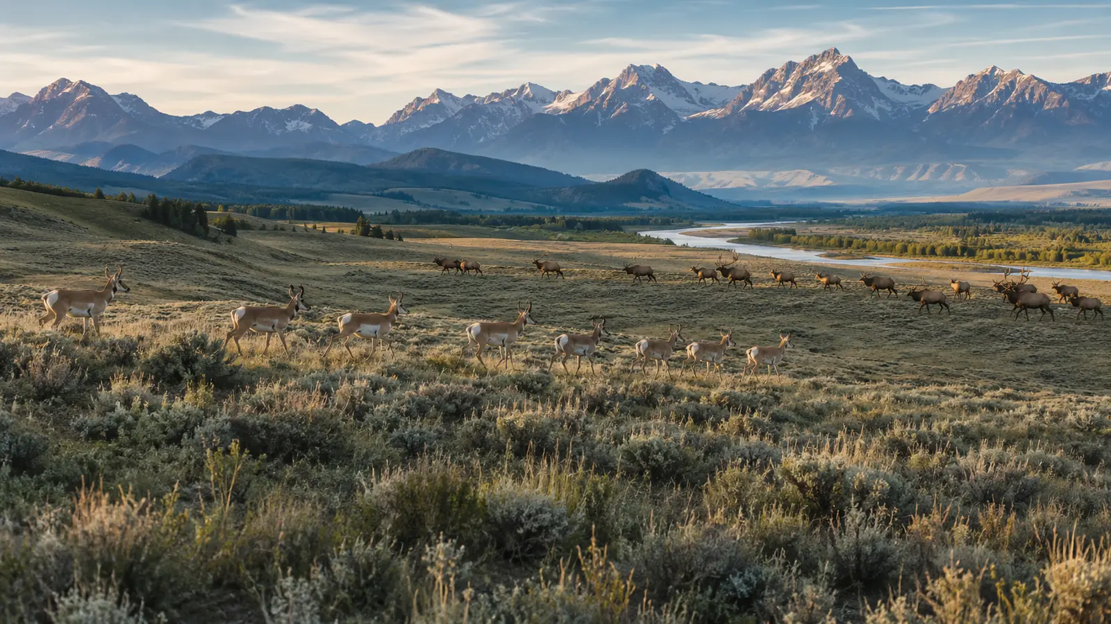
Living WyomingWild Landscapes, Shared Future
LIVING NATIONS, LIVING CULTURES
Indigenous history in Wyoming did not end when territorial boundaries were drawn or when Wyoming became a state.
The Eastern Shoshone Tribe and Northern Arapaho Tribe are sovereign tribal nations whose communities are centered on the Wind River Indian Reservation. Their governments, cultures, languages, businesses, schools, families and traditions are part of Wyoming today.
The Wind River region also carries deep historical importance connected with treaties, federal policy, land, water and the long relationship between Native nations and the United States government. Modern issues involving economic development, health, education, natural resources, cultural preservation and sovereignty cannot be understood by treating Native people simply as figures from nineteenth-century history.
The correct Wyoming story begins with Indigenous peoples.
And Indigenous peoples remain part of Wyoming's present and future.
BIG LAND. SMALL POPULATION.
Wyoming is America's least populous state, yet it covers more than 97,000 square miles. That contrast is fundamental to understanding life here.
The state contains cities, college communities, energy towns, ranching communities, tourism centers, tribal communities and extremely small rural settlements separated by vast distances. Cheyenne and Casper function as important population and economic centers, while communities such as Laramie, Gillette, Rock Springs, Sheridan, Jackson, Cody, Riverton and others possess distinct regional identities.
Low population density creates advantages valued by many residents: space, access to outdoor landscapes and communities where personal relationships can remain important. It also creates challenges. Health care, transportation, education, infrastructure and public services must sometimes be delivered across extraordinary distances to relatively small populations.
Wyoming's scale is therefore deceptive.
The map is enormous.
The human network is intimate.
BUILDING WYOMING'S FUTURE
The University of Wyoming opened in Laramie in 1887, before Wyoming achieved statehood. More than a century later, it remains the state's public university and an important center for education, research, athletics and public service.
Education across Wyoming also includes community colleges, public schools, technical programs and workforce-development systems serving communities with very different economic needs. Agriculture, energy, engineering, health care, tourism, technology, public administration and natural-resource management all require knowledge and skills that continue evolving.
For a state with a small population, retaining and attracting young people is particularly important.
Wyoming's future will depend not only on what lies beneath its ground or across its landscapes.
It will depend on what its people know, create and build.
THE WYOMING THE WORLD COMES TO SEE
For millions of visitors, Wyoming is encountered first through landscape.
Yellowstone.
Grand Teton.
Jackson Hole.
Devils Tower.
The Bighorn Mountains.
Historic trails.
Wide-open roads.
Western heritage.
Outdoor recreation and tourism have become important parts of Wyoming's economy, supporting hotels, restaurants, guides, transportation businesses, retailers and communities located near major destinations.
Yet tourism also creates pressure. Popular destinations must manage traffic, housing, seasonal employment, infrastructure, wildlife interactions and the challenge of protecting the qualities that attract visitors in the first place.
The world's image of Wyoming is often a mountain, geyser, bison or cowboy.
The real Wyoming is considerably more complex.
CHEYENNE
From Railroad Town to State Capital
Cheyenne began as a railroad community in 1867 and became the political center of Wyoming Territory. Today it remains Wyoming's capital and its largest city.
The Wyoming State Capitol stands as one of the most recognizable symbols of state government, while the city's history remains visible through railroad heritage, historic neighborhoods and institutions that developed across generations. Cheyenne is also closely connected with F.E. Warren Air Force Base, state government, transportation, business and the agricultural communities of southeastern Wyoming.
Each summer, Cheyenne Frontier Days brings the city's western heritage before visitors from across the country and around the world. Yet modern Cheyenne is more than a celebration of its past. It is a working capital city positioned along major interstate corridors and close to the rapidly growing Front Range region to the south.
The railroad created Cheyenne.
Government sustained its importance.
The military expanded its national role.
And today the city remains the political heart of Wyoming.
WHAT COMES NEXT?
Wyoming entered the twenty-first century carrying an extraordinary inheritance.
Its Indigenous history reaches back thousands of years.
Its trails helped carry enormous migrations across a continent.
Its railroad helped build communities.
Its territorial government became a pioneer of women's political rights.
Its landscapes helped create the national park, national forest and national monument traditions.
Its ranches helped define the mythology and reality of the American West.
Its minerals and energy resources helped power a nation.
Its military installations became part of America's defense.
Its wildlife and public lands remain internationally significant.
Now Wyoming confronts questions shared by many places but intensified by its distinctive geography and economy: how to diversify economic opportunity, how to navigate changing energy markets, how to protect wildlife and open space, how to sustain rural communities, how to educate and retain young people, how to use technology without losing community, and how to balance development with conservation.
There is no final chapter to that story yet.
Because Wyoming is still writing it.
The Complete Journey
12,000+ YEARS OF WYOMING
Move across the defining eras and return to any chapter through the journey navigator.
Ancient WyomingIndigenous peoples live across the region for thousands of years.1800sExploration, fur trade and expanding American movement reshape the region.1840s–1860sHundreds of thousands of emigrants travel the great overland corridors.1867The railroad enters Wyoming and Cheyenne emerges.1868Wyoming Territory is created.1869Women gain voting rights in Wyoming Territory.1872Yellowstone becomes the world's first national park.1887The University of Wyoming opens.1890Wyoming becomes America's 44th state.1891The forest reserve that becomes Shoshone National Forest begins another conservation first.1906Devils Tower becomes America's first national monument.1925Nellie Tayloe Ross becomes America's first woman governor.1942Heart Mountain becomes part of a difficult chapter of wartime American history.1945 onwardHighways, aviation, energy, national defense and modern institutions transform the state.TodayWyoming remains the Equality State and Cowboy State: a place where enormous landscapes, natural resources, history, wildlife and a small population continue shaping one another.
WE CAME TO WYOMING AFTER THE HISTORY WAS ALREADY HERE.
The mountains were here.
The plains were here.
The wildlife was here.
Native nations had called this region home for generations beyond counting.
Emigrants crossed it.
Railroads connected it.
Ranchers worked it.
Miners went beneath it.
Women changed American political history here.
Americans created new ideas about conservation here.
Communities survived winters, wars, economic change and generations of transformation.
Wyoming does not need a new organization to give it a story.
Wyoming already has an extraordinary story.
The responsibility of anyone who chooses to make this state home is different:
To learn that story.
To respect it.
To contribute to what comes next.
NOW, THIS IS OUR HOME.
THE HISTORY BROUGHT US HERE.
CONTINUE ↓
OUR HOME — WYOMING
FINAL CHAPTER
Why Shaker Global News chose Wyoming. Why Cheyenne became home. Our responsibility to the state that welcomed us. Wyoming coverage. Local history. People. Communities. Wildlife. Service. And a permanent commitment:
Founded in Wyoming.
Headquartered in Wyoming.
Serving Wyoming.
Serving the World.
06
Part 6 of 6
Our Home — Wyoming
The final chapter
Part 6 of 6
OUR HOME — WYOMING
After traveling through more than twelve thousand years of human history, one truth becomes impossible to miss: Wyoming did not begin with us, and its story does not belong to any single generation.
Indigenous peoples knew these landscapes thousands of years before modern borders existed. Emigrants crossed them. Railroads transformed them. Ranchers and farmers worked them. Miners and energy workers drew resources from beneath them. Women helped change American political history here. Conservation ideas born in Wyoming helped influence how nations think about protecting extraordinary places. Communities endured economic change, war, severe winters and the enormous distances that continue to define life across the state.
Shaker Global News enters that story very late.
That is precisely why our responsibility begins with respect.
WHY WYOMING?
Shaker Global News chose Wyoming as its institutional home during a period of significant expansion and transition. Cheyenne offers something increasingly rare: a state capital that remains personally accessible, historically significant and closely connected to the wider identity of the state it serves.
Wyoming's scale also reflects many of the subjects Shaker Global News intends to cover seriously. Here, questions of public land, wildlife, agriculture, energy, national defense, rural communities, Indigenous sovereignty, conservation, history, economic development and government are not distant abstract subjects. They are part of everyday Wyoming life.
For a news organization with international interests, choosing Wyoming also creates an important discipline. Global reporting should never become an excuse to overlook the community outside our own door. If Shaker Global News intends to report on people, institutions and humanitarian issues around the world, it should also learn the history, communities and concerns of the state it calls home.
Wyoming therefore becomes more than an address.
It becomes a responsibility.
WYOMING WILL NOT BE A ONE-TIME STORY
This page is intended to preserve Wyoming's long historical story, but Shaker Global News' commitment to the state cannot stop with history.
Wyoming continues changing every day. Decisions involving government, education, energy, agriculture, wildlife, public lands, transportation, military affairs, tourism, business, communities and economic development shape the state's future. Some changes happen in Cheyenne. Others begin in small communities many miles from the capital. Some become national stories. Others matter deeply to only a few thousand people—but those stories still deserve attention.
The permanent Wyoming Today section of Shaker Global News will therefore continue publishing approved reporting, historical features, community stories, interviews, public-interest information and other material concerning Wyoming.
The objective is not to compete with Wyoming's existing local newspapers by pretending SGN can replace them.
The objective is to contribute another serious editorial voice while building a permanent archive of the state Shaker Global News calls home.
A Permanent Wyoming Editorial Commitment
WHAT WE WILL FOLLOW
Government & Public Affairs
Decisions affecting Wyoming residents and communities.
People & Communities
The individuals and local stories that give Wyoming its character.
History & Heritage
Preserving Wyoming's extraordinary historical record.
Wildlife & Conservation
The species, landscapes and ecosystems that make Wyoming internationally significant.
Energy & Economy
The industries, technologies and decisions shaping Wyoming's economic future.
Agriculture & Ranching
The people working the land and carrying forward one of Wyoming's defining traditions.
Education & Young People
Schools, universities, opportunity and the future generation of Wyoming.
Military & Service
Wyoming's connection to national defense and the people who serve.
Places to Discover
Cities, towns, historic sites, landscapes and destinations across the state.
Wyoming Today
Current SGN stories from across the Equality State.
CHEYENNE — OUR HOME BASE
Cheyenne began beside the railroad in 1867 and soon became the political center of Wyoming Territory. More than a century and a half later, it remains the capital of the state.
For Shaker Global News, Cheyenne is now more than a historical subject.
It is home.
From here, SGN can look in two directions at once: inward toward Wyoming and outward toward the wider world. That combination is central to the identity we want to build. A global news organization should understand that international perspective and local responsibility do not compete with one another.
They strengthen one another.
Cheyenne gives Shaker Global News a physical place from which to build that responsibility.
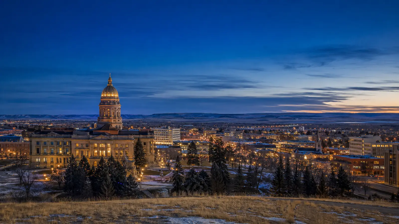
Cheyenne · WyomingOur Home, Looking Outward
SERVICE BEGINS WITH LISTENING
Shaker Global News is still growing. For that reason, we will not make grand promises about what we will accomplish for Wyoming before we have earned the right to make them.
Our first obligation is simpler.
Listen.
Learn.
Report accurately.
Preserve history carefully.
Recognize achievement.
Ask difficult questions when necessary.
Correct mistakes when they occur.
Give people and institutions a fair opportunity to respond.
And remember that credibility is built over time.
Wyoming does not need exaggerated claims from a new organization.
It deserves serious work.
WYOMING PEOPLE
A state is more than geography, institutions and statistics.
It is people.
Future Shaker Global News coverage will introduce readers to Wyoming residents whose work, service, creativity, history, leadership or everyday lives help explain the state from the inside.
Some will be widely known.
Others may never have appeared in a major publication.
Both can matter.
PLACES TO DISCOVER
Wyoming is too large and too varied to understand through a single city or landscape.
The state changes as you travel.
The railroad and government history of Cheyenne differs from the university culture of Laramie. Casper developed within another regional economic story. Sheridan reflects northern Wyoming and its ranching heritage. Cody stands close to Yellowstone and carries a history deeply associated with the American West. Jackson sits beside one of the world's most recognizable mountain landscapes. Gillette, Rock Springs and other communities tell important stories about energy, migration, work and economic change.
The purpose of this section is not simply tourism.
It is understanding Wyoming place by place.
FROM WYOMING TO THE WORLD
Shaker Global News was created with international interests, but every global institution exists somewhere.
For us, that somewhere is Wyoming.
The stories published from here may concern Asia, Africa, Europe, the Pacific, humanitarian affairs, anti-corruption, nonprofit initiatives, American history or international developments. Yet our physical home remains in Cheyenne.
That creates a simple principle for the organization:
Know where you stand before looking at the world.
Wyoming gives Shaker Global News that place to stand.
OUR HOME — WYOMING
We arrived after thousands of generations had already left their mark on this land.
We inherited none of their struggles, achievements or sacrifices.
But we can learn from them.
Wyoming's story teaches us that a place can be ancient and still change rapidly. It can protect extraordinary landscapes while developing extraordinary resources. It can possess one of the smallest populations in America while influencing national history. It can preserve traditions while confronting new technologies, new industries and new generations.
Shaker Global News is proud to call Wyoming home.
That pride carries a responsibility: to learn before speaking, to report before promoting, to respect history, to recognize people and communities, and to contribute something useful to the state that now gives our organization its home.
Our headquarters may be in Wyoming.
Our reporting may travel around the world.
But home matters.
INCORPORATED IN WYOMING.
HEADQUARTERED IN WYOMING.
SERVING WYOMING.
SERVING THE WORLD.
Welcome to Wyoming.
Welcome to Wyoming.
Our home. Our responsibility. A story still being written.
WYOMING
More than twelve thousand years of human history.
A land of first peoples, western trails, equality, conservation, ranching, energy, wildlife, service and change.
A state whose population is small but whose place in American history is enormous.
And now:
OUR HOME.
Incorporated in Wyoming. Headquartered in Wyoming. Serving Wyoming. Serving the World.
Continue Exploring
Explore Wyoming
Move through Wyoming history, places, people and the reporting that continues today.
Wyoming Today
Latest from Shaker Global News
History explains how Wyoming became what it is. Journalism follows what happens next.
Our Home. Our Responsibility.
Wyoming
More than twelve thousand years of human history—and a story still being written.
Return to Shaker Global News →